top of page
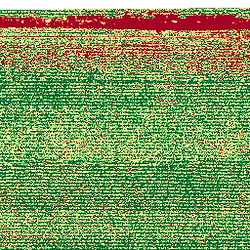
NDVI MAPPING
1 hr1 hCustomer's Place
2 US dollars
$2
Service Description
We collect imagery, and create accurate mosaics and vegetation index data layers. We use a fully contained dual camera payload integrated with built-in global navigation & GPS aiding. Cost is $2 an acre with a minimum charge of $100.


Contact Details
droneshotz72@gmail.com
bottom of page